Pages

Sunday, June 18, 2017

Onward to Dawson City, YT and Tok, Alaska

Our plan for the next week is in an area that I do not expect any cell phone or internet. So here is the plan. We leave Whitehorse (1) and travel, maybe to Mayo (2) and on to Dawson City (3).
After that, we ferry across the Yukon River (1) and make our way to Chicken, Alaska and on to Tok (2) to meet up with George.
George will travel along the Alaskan Highway and meet up with us later. We will miss his company but really wanted to do this part of the trip. So on we go!

We'll check in again, hopefully at Tok!

June 18: Relaxing in Whitehorse

We decided to spend a day in Whitehorse doing some errands and reorganizing, etc. It has been a beautifully sunny day with temperatures in the 60s-70s all day.


One highlight of the day was a visit to the S.S. Klondike II, which was a stern-wheeler riverboat that ran the Yukon River from Whitehorse to Dawson City (460 miles) from 1937 to 1955. It could carry 300 tons of freight and passengers. Very interesting!
The boat had only a 4 foot draft so it could navigate the river.
The freight deck also accommodated the 2nd class passengers. Yearly earnings for this time were about $25/year and that was the cost of this trip.
Both 1st and 2nd class passengers had access to the sun deck.
First class passengers ate and lounged in luxury for $35 for the trip with nice private sleeping compartments.
This deck was not accessible to the 2nd class passengers
We had a wonderful day exploring this historic boat!


June 17: Going to the Capital of the Yukon Territory

The morning started at 45 degrees and was 58 degrees by the time we left camp. However, it was cloudy, drippy and foggy. It’s 100 miles to Whitehorse, the capital of the Yukon.

There was no opportunity to take pictures today as the clouds hid every viewpoint and mountain along the way. We ended our day at the Caribou RV Campground just south of Whitehorse, YT. This is a great campground and there is a restaurant next door called the Wolf Den. George treated us to dinner there and it was wonderful. Thank you, George.


Drove: 91 miles

June 16: Traveled to Teslin

We start out the day at 55 degrees and sun, but the weather becomes spotty. We stopped along the way at a rest stop for lunch and Duane spotted a mountain that he thought resembled George a little and called it George Mountain. What is funny is that a few feet down the road there was a George’s Gorge! What do you think?

This was the one time today that we could see the mountains as the clouds covered them the rest of the afternoon. Here was our view at this stop.


At Rancheria Falls we decided that a walk to stretch our legs was a great idea. The path brought us to where the river divided and produced two falls.
We went over the Continental Divide today. However, the weather became nasty! We had a little hail and then near snow on the windshield. The day ended with us staying at Teslin Lake Campground. Teslin Lake is 84 miles long and the name means “long and narrow.” It is long, but the average width is 2 miles. It would have been beautiful, had the weather not been so cold and wet.

Drove: 173 miles

June 15: Toward Watson Lake

We woke up to sunny skies in our rest area and were able to take new pictures of the beaver dam. The blue of the water was quite vivid.

It was sunny, yet there were low clouds. Here is Stone Mountain:
 Can you see it? Maybe in this closer look.

Then we were able to see the Sawtooth Mountains, an accurate description of the row of mountains in this range.

Our next stop was the hot springs at Liard. Duane dipped there with some of the people that we have net along the way. Here you see Steve and Robert, friends we have met along the way. 

The closer you got to the hot spring (in the background) the hotter the water became.


Along the road, we did see a moose, but it was too late to stop and there was no wide place in the road to stop. At a stop later on, we encountered bison. There were several adults and three young ones.

Still further, down the road we encountered two black bear. One was close enough to the road for us to get a great look at him/her (I didn’t want to get close enough to find out!).

That evening we stayed at Tags RV Campground (not very impressive, but it did have showers and laundry). Across from the campground is an information center and the Watson Lake Sign Forest. This began as a small expression of people’s hometown and blossomed into over 83,000 signs. There is no way to look at all of them, so you just hope you see something interesting. Here are some that I found:

Drove: 226 miles

June 14: On toward Fort Nelson

It rained overnight again and we woke to cloudy skies. Here’s an example of the sights we are able to see. 
They have cleared large areas along side of the highway, partly as a firebreak, but also so animals are more visible for passing motorists. However, because of it, they like the fresh grass and other new plants. They are also attracted to the salt on the edge of the highway.

 We came across two Stone Sheep! They are darker and a little smaller than the bighorn of the Rocky Mountains and indigenous to northern BC and southern YT.

However, we did not see the mountains. There is a beautiful viewpoint at the top of Summit Peak and a mountain called Indian Head, and also a Teetering Rock. None of these was visible through the fog and rain!

We ended up at a rest area where a creek came into the Tetsa River. There was a path to the river and a beaver dam. The water was clear and cold, but oh so beautiful!
Drove: 234 miles

We changed travel plans. Here’s what’s new!

Because of the storms and snow in Banff and Jasper we opted for a different travel plan. Here is where we are from June 10-17.
  1. June 3-5: Eagle Nest RV, Polson, Montana
  2. June 6: Elko Rest Stop, BC
  3. June 7-9: Bow River Provincial Park & Willow Rock Campgrounds, AB
  4. June 10: Springhill RV Park, Cochrane, AB
  5. June 11: Walmart, Whitecourt, AB
  6. June 12: Hythe Municipal Campground, Hythe, AB
  7. June 13: Sikanni River Campground, AB
  8. June 14: Rest Stop near Summit Peak, AB
  9. June 15: Tags RV Campground, Watson Lake, YT
  10. June 16: Teslin Campground, Teslin, YT
  11. June 17: Caribou RV Campground, Whitehorse, YT

Friday, June 16, 2017

June 13: Sunny day!

We drove onward toward Dawson Creek and Mile Zero, with a sunny day. Our temperatures have been in the 40s at night and 50-60s during the day.

We made it!


We spent some time at the museum there and found more brochures about the Alaskan Highway. The highway was essentially an American effort (with Canadian approval) to create a way of getting military troops and supplies to Alaska during WWII. It's quite interesting and the effort made to get it done in record time is amazing!

We drove a section of the original highway, which goes over a wooden curved bridge. Beautiful scenery there and the bridge is a marvel.


We stayed at the Sikanni River Campground right on the river. This campground is at the bottom of a valley and a LONG 6-9 percent grade hill.

Drove: 210 miles

Monday, June 12, 2017

June 12: On the Way to Mile Zero (Updated)

Last night we stayed at a Walmart parking lot in Whitecourt, Alberta. We left the lot about 9 am Mountain Time and did some errands prior to leaving town.

I was able to participate by phone with my women's Bible study at Elim for a while until I was out of cell range. It was wonderful to hear everyone's voices again after the few weeks we've been away from study. We are starting a new study on grace in Colossians and Philemon.

It started out a bit cloudy with a temperature of 55 degrees but turned into a wonderfully sunny day in the 60's.

When we pulled over to have a little lunch, I came across a beautiful moth (Papilio multicaudatus Kirby). It was in the driveway and I placed a napkin for it to crawl upon and the moved to the grass. I pray that it survived!

The scenery from the wayside that we stopped in was wonderful. You can see for miles and miles!


Then we entered into Grande Prairie, Alberta. We had planned on only a quick stop for gas and a check on our coach battery that doesn't seem to hold a charge. It turned into a real mix-up. Costco in Canada will not accept our credit card, the two places we went to did not have a way to check the battery, etc. We ended up at Canadian Tire were Duane discovered that our coach battery was losing charge under load--so, a new battery to fix that problem. We finally did what we came into Grande Prairie to accomplish and were on our way.

We ran through and did not stop at Beavertown, but here is the beaver!

After such a difficult and frustrating time, and because it was already 2:30p, we opted to stop relatively soon and get to mile zero tomorrow morning.

We are now at the Hythe Municipal Campground for the night. We have electricity and showers, so we are good for $25 (Canadian). The campground manager stopped by and said that next year they hope to have water and sewer at each site. That is quite an investment for a small town. The only problem we will have going over to the showers is the mosquitos! There seems to be an overabundance of them!

They city created the bathrooms and showers inside a caboose. We did a quick supper and shower, then settled for the night.
Animals:
  • Deer
  • Elk (however, they were in an enclosure. Still magnificent animals!)
Onward to mile zero in the morning!

Drove: 224 miles

Sunday, June 11, 2017

June 11: Closer to the Alaskan Highway

We woke to 39 degrees and 34 degrees wind chill. Thankfully, the camper was about 20 degrees warmer than that! We were thankful that we were not in the 103-degree heat index at home, not in the path of the thunderstorm that went through the Twin Cities during this day. We were to learn later in the day that everything at our home was okay, but many people were out of electricity or had their homes damaged by incredible 1.5 inches or more hail.

We left the Spring Hill RV Campground around 8 am and went north on Highway 22 toward Highway 43 and up to Whitecourt, Alberta.

The mountains after the storm to the west that we avoided were white with snow.


What a beautiful site! There was sunshine on the mountains, but cloudy where we traveled. We were in cloudy skies most of the day and only a little rain.

Our goal tomorrow is to make it to mile zero on the Alaskan Highway at Dawson Creek.

Animal sightings:
  • There was a deer along one field that pranced like a fancy horse. It was a delightful dance.
  • We had a black bear cross the road in front of us that was quite a good size.
  • Also, we saw a herd (it that correct?) of horses that were running across a field. There were at least 8 foals with them. It was great to see this wild and joyful display!
Oddities:
  • On the overhead sign above a ranch road, it said “Bob the Welder: Gateway to the World of Welding.” It might have been fun to see what Bob offered in lessons.
  • On a sign for an Esso station, it declared that it was a “stunning pee stop.” Not quite sure what that meant.
  • The best thing today, however, and I wish we had a picture of it, was a derrick that someone had decorated it with a cowboy on a horse. When the derrick went up and down, it looked like the cowboy was riding a bucking bronco. Very cute!
Drove: 250 miles

Saturday, June 10, 2017

June 10: Change in Plans

We woke with bad news. Rain, sleet, ice and snow was going to be on the road we had planned to travel up to Jasper. As our real destination is Alaska, we opted for Plan B: go around the bad weather.

This was not a good day for photos, so, sorry, there are none today (apologies to PB). By the time we left Willow Rock campground you could see the snow and fog enter behind us. We traveled toward Calgary and went north on highway 22 to Cochrane. Here we have found a campground at Springhill RV Park for the night. We have traveled only about 60 miles or so today.

The temperature is 41 degrees with a wind chill of 32 degrees. We hear that there is a heat index of 103 degrees at home. WOW, what a contrast! The wind has been upwards of 20 mph with gusts over 30 mph--not something that you drive in with an RV.

We hope that the morning fairs better for us and the Lord grants us good traveling weather. We hope to travel up to Whitecourt, Alberta, tomorrow and the through Grande Prairie and the Alaskan Highway the day after.

As a delightful end to our day we have a double rainbow. This may be our sign that tomorrow will fair better. We pray that it does.


June 8-9: Banff Area

June 10: City of Banff

We drove into town in George's Jeep and up to the Banff Gondola ride. George waited for us at the bottom as Duane and I went to the top. You can see the beginning of the trip at the small white building in this picture.

So, the trip up is quite far above the base of the valley, and the views are spectacular. Some of the views included Mt. Rundle and a view of the city of Banff.


The large hotel in the center of the picture is Banff Springs Hotel. It is quite the place to stay if you have the money to do so.

At the top of the ride, you can read placards about the scenery that you see. There is also an inside interpretive center which gives you information about the history, animals, weather, etc. The tower you see in the next photo was the original weather station that was built around 1916. The walk to it involved LOTS of steps and we opted not to go there.

The information about the animals (grizzly, cougar, etc.) was interesting. They had paw prints and here is Duane's hand in comparison to the grizzly.
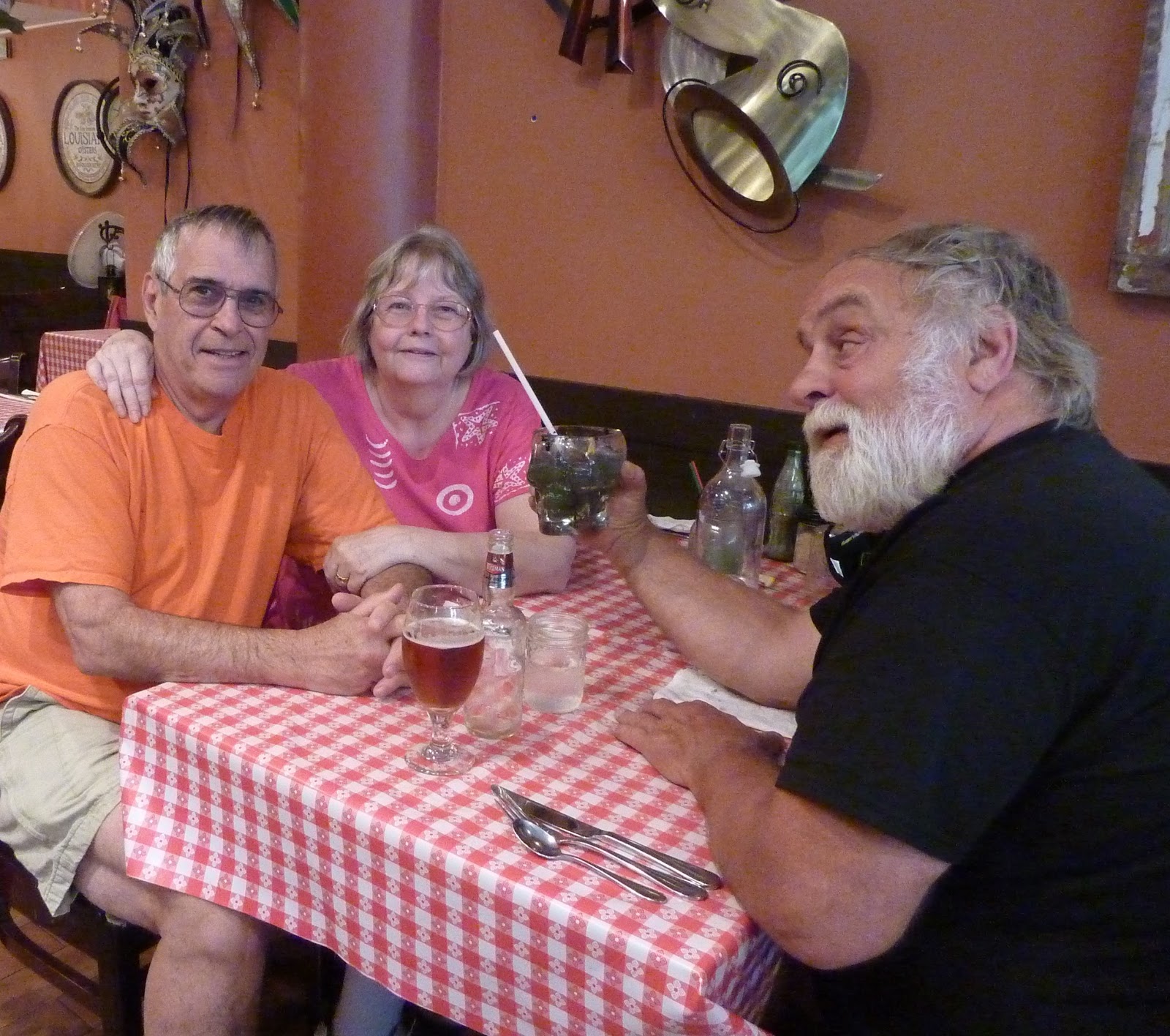
We ended the afternoon with a small rain shower and a walk through part of downtown Banff. We ended up at Tooloulou's (with a gluten-free) Cajun menu.


June 9: Weather wait-out

We woke up to very bad indicators about roads and weather north of Banff. Our plan was to go north to the ice fields today. However, a weather system has come in that is bringing rain and cooler temps with possible snow. It's time to stay put.

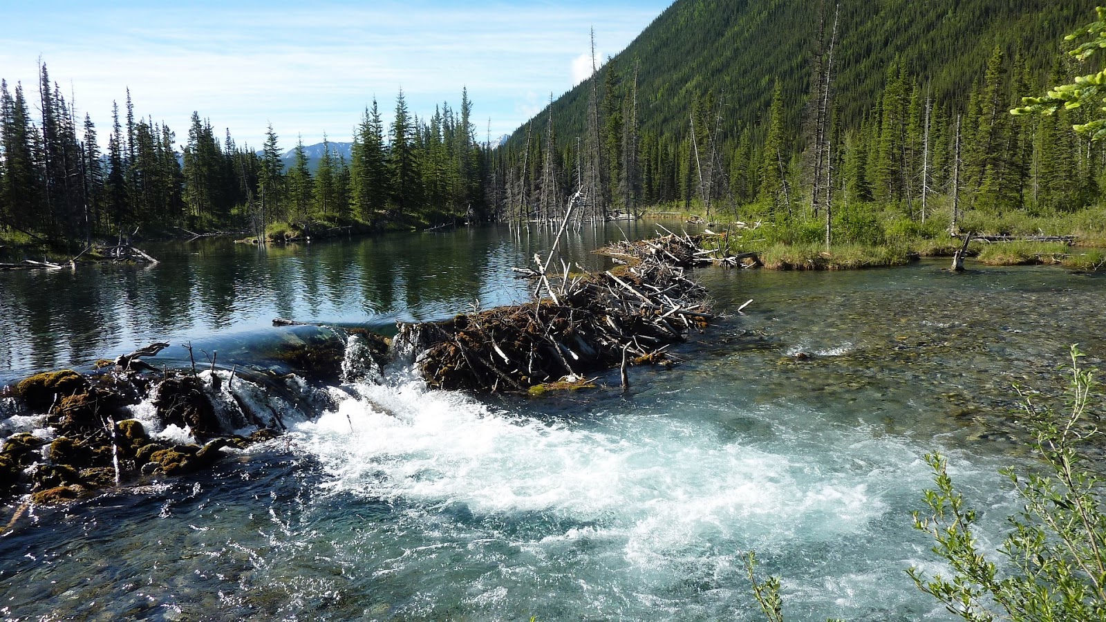
Being as we had plan to leave. We had to move our campsite from Bow River to Willow Rock campsite (only across the road). With the day to ourselves, Duane and I went for a walk on the Flowing Water Trail. There was an incredible variety of flowers on the walk and it was a wonderful quiet trail. From the top of the trail there was a bench and this wonderful view.
When we were below, at the bend of the river to the left there was a pair of geese and four goslings. The river was running quite swiftly. The parents went into the water first and waited for the young ones to enter into the water. Then, they traveled upstream close to the left bank (one adult, four goslings, and the last adult). When the water was too swift, they traversed the river together in the same order. After reaching the far right ride (which was a shear bank with nowhere to go ashore), they traveled again upstream in the same order to a sandbank. It was a wonderful view of their protection of their offspring.

The walk had a variety of landscapes: river, plane, and wetland. This shows some of that contrast, both in landscape and color.

June 7: On the way to Banff

We woke up at the rest area at 39 degrees at 6a and found truckers in the rest area and all along a side road. By the time we left at 8a the temperature had moderated at 59 degrees.


We drove along Highway 3 through Fernie, Sparwood, and Crowsnest. In Sparwood, we saw the “Largest Truck in the World” used in the mining operations around there.

Then we stopped at Frank, which is the site of a large rockslide, which on April 29, 1903, saw 30 million cubic meters (over 39 million cubic yards) of limestone burying part of the town. Its depth was from 150 meters (492 feet) to 450 meters (1476 feet). The side of the mountain slid into the town in a matter of 90 seconds. Surprisingly, only 90 died, most of who are still under the rockslide today.

Along the way to Calgary we came across a strange site—fenceposts with hats upon them for probably a mile—not sure why!

We ended up at Bow Valley Provincial Park east side of Canmore, MT. What a great view from my campsite.